
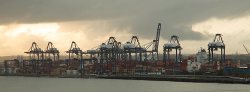
We started our transit of the Panama Canal about 7:30 AM on the Colon side (the North side or Caribbean side). Panama actually pretty much runs east west causing confusion about directions. Colon is a huge port city with lots of activity. Ships were queueing up to enter the canal as well as other working ships.
As we came into the bay of the canal, we went under a bridge they are building over the canal. It appears to be a huge engineering project. Here are a couple of pictures.
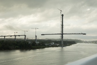
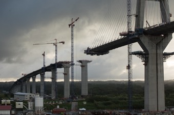
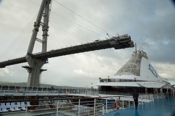
I was concentrating on one side of the ship taking pictures and another passenger said I need to look at the other side. We were going under another piece of the bridge. It looks like our ship will hit the bridge, but it cleared with many feet to spare.
A few facts about the canal. It is 50 miles long. There are three locks on each side of the canal. The middle is mostly Gatun Lake formed by damming up the Chagres river. Damming the river was a big step in minimizing the amount of earth moving that was necessary. The locks operate using gravity. In addition, they use the elevation drop in the water to generate hydro-electricity.The lock raise/lower the boats from sea level to lad level--26 meters (about 90 feet) above sea level. It takes 8-10 hours for a complete transit. Our boat had a tug boat trailing us and there were 2 canal captains on board steering the boat.
The canal cost $650M dollars to build and it finished under budget and on time. After 20 years the French gave up and left and then it took American 10 years to finish the canal. Many lives were lost (25,000 French (mostly) and American efforts combined). 268 million cubic yards of earth moved. Tolls range from $0.36 for a swimmer to $1.2M. Our ship’s toll was $310k.
The history of the construction is a fascinating story. I highly recommend “The Path Between the Seas” by David Mc. It tells the story of the canal from the failed French attempt to the issues that had to be solved to be successful. Well worth the time to read.
Pictures, as usual, tell the story better than words.
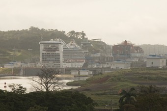
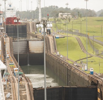
Left: They have recently opened new locks which allow larger ships to transit the canal. The locks are 60% wider and significantly longer as well. You can see a huge cruise ship in the new locks. Unfortunately it was a very hazy day so the pictures is not clear. Right: The ship (red hull, white upper part) is entering the top lock. You can see the next two locks in the picture.
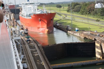
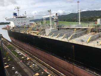
Left: That same ship in the second lock. The locks open inward after the water level has equalized. Below the lock the structure with a yellow fence is actually a road for traffic to cross the canal. It swings out of the way when the locks open. Right: You can see how close the ships come to the edge of the locks. There are train engines (mules) that are used to maintain stability in the lock. But, the ship moves in the lock under its own power.
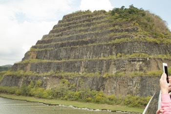
About 10 miles of the canal is in the Culebra cut (on right). It is the channel where they had to move the most earth to get through the Continental divide. They had some incredible machines to move the dirt. One of those machines could move 1,000 tons of earth and rock an hour. The cut is still an issue because of mud slides. They are constantly dredging the channel to keep it deep enough. Traffic in the cut is one-way. It is too narrow for 2-way traffic.
There are three locks on the Pacific side as well. One drops the ships down into a small lake. A couple of miles later the final two locks bring you to Pacific Ocean sea level. E cleared the final lock around 4:00 PM. As you sail out of the channel, you get the view you see below.
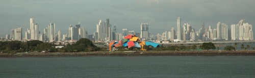
The skyline of Panama City is beautiful. The building in front is a museum designed by Frank Geahry. We didn’t get a chance to visit that museum.
It is an incredible experience and MUCH more could be written about it. If you ever get the chance, you should definitely do it.